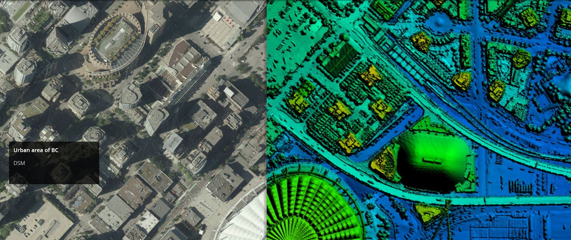
Digital surface model (DSM) data for an urban area in BC. DSMs are derived from LiDAR point cloud data.
Over the past several years, the Province of British Columbia has made significant investments in LiDAR and has now released provincial LiDAR collections known as LidarBC under the Open Government License. This data is now freely available for anyone to download and use via the LidarBC Open Data Portal.
Until recently, British Columbia was without publicly available LiDAR data. This limited access, combined with large file sizes, greatly limited the potential of many in the GIS world to conduct research using this rich data source. The LidarBC program has taken the LiDAR point cloud data from large areas and divided them into smaller, more manageable blocks of data, resulting in file sizes that will not overload browsers. To that end, the Portal uses a provincial map divided by tiles that allows users to locate the data they want precisely, without obtaining necessary excess data. This new tool, developed by Caslys Consulting, also contains a user-friendly interactive guide that shares valuable information on the step-by-step processes needed to use LidarBC’s Open LiDAR Data Portal.
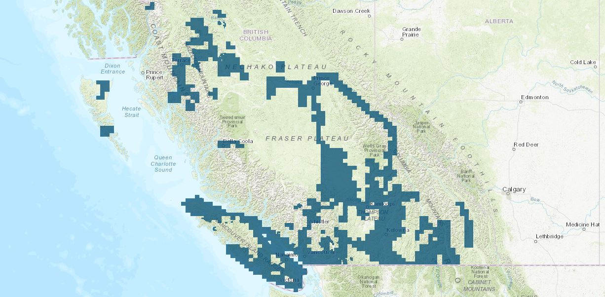
LidarBC data coverage areas are shown in blue.
What is LiDAR?
LiDAR (Light Detection And Ranging) is a uniquely accurate method for elevation acquisition, acting as an active remote sensing system that produces its own energy for acquisition of information. These LiDAR systems are made up of a laser, scanner and GNSS (GPS) receiver that are mounted onto an aircraft. The systems transmit short, high-frequency wavelengths of light to a surface, then record the time of flight and intensity of the back scatter returned to the sensor that make up a point cloud data set. The high spatial resolution of the resulting surface models allows the differentiation of many fine terrain features in both urban and natural environments. The Province of British Columbia now has this powerful active remote sensing system of LiDAR point cloud and derivative data sets, DEM and DSMs, available for download from the Portal.
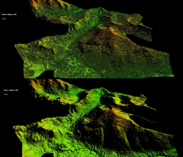
Visualization of digital surface model (DSM) data and digital elevation model (DEM) data for River Valley, BC. DSMs and DEMs are available for download via the LidarBC Open Data Portal.
How is LiDAR used?
LiDAR point cloud datasets and their derived products (e.g., DEMs and DSMs) can be used in a wide variety of spatial studies regarding both urban and environmental land management and planning efforts. The versatility and high resolution of LiDAR data and derivatives make these datasets extremely useful for applications in climate monitoring, hazard assessment (e.g., landslides, lava flows, tsunamis, and floods), city planning, agriculture, forestry, geology, meteorology, mining, vehicle navigation, watershed and river surveys, and much more. This remote sensing system can help in understanding the topography of Earth’s surface, and can even measure some atmospheric gases and particles to help better understand changing emission levels and air quality.
This exciting new catalogue of BC LiDAR data marks progression within the evolving network of open-sourced information. The possibilities are endless…how will you use LiDAR data?
To explore and learn more, please visit the LiDAR Open Data Portal.
Written by Dave Warren
I’m using LiDAR data to help find suitable terrain for building mountain bike trails. I’m a director with the FVMBA, and share our trails with hikers and trail runners. The DEM datasets allow us to plan new trails way more efficiently, saving many days’ time in the field. LiDAR rocks!