Agricultural Land Use Inventory for the Province of British Columbia
Our team applied image classification techniques to develop agricultural land use inventories through the classification of SPOT / Sentinel-2 imagery for multiple study areas including the Peace River Valley, B.C. (completed March 2017), Cariboo Regional District, B.C (completed March 2020), Regional District Kitimat-Stikine (completed April 2020), and Bulkley Valley Regional District.
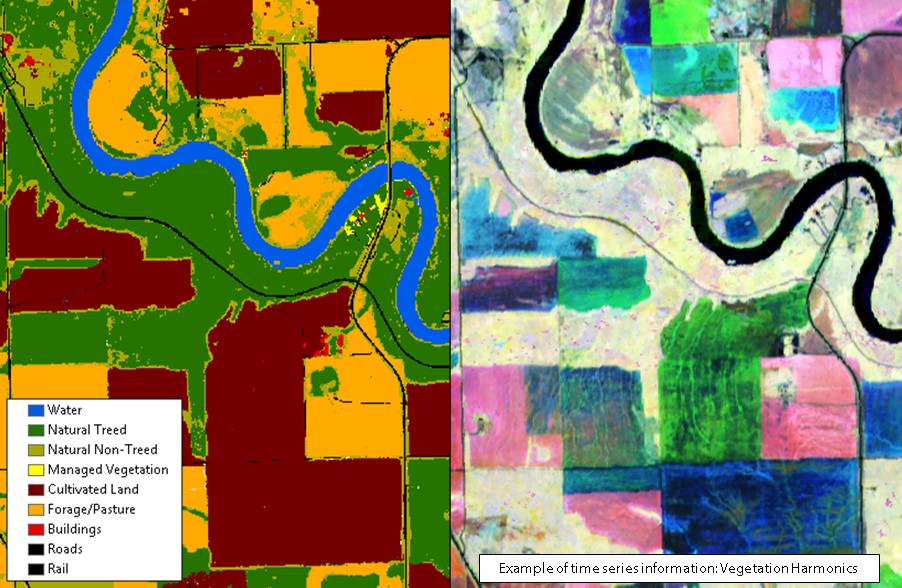
Caslys’ approach to developing agricultural land use inventories has evolved over the course of this project, reflecting the unique regional image classification requirements encountered in each area. For the most recent phases of the project, we have adapted our approach from an unsupervised classification to a supervised random forest classifier to accommodate a wider range of input variables including Sentinel-2 time series information, Sentinel-1 radar imagery, and LiDAR data. The diversity of input variables improves the classification results by providing different spectral characterizations of natural and agricultural land covers, facilitating the separation of agricultural crop types, and refining the delineation of anthropogenic features. The random forest classifier groups pixels into classes based on training site information. Any confusion remaining in the classification is minimized through a series of post-processing masking steps using ancillary data layers. The final classification product is delivered to our project partners in the Ministry of Agriculture who further delineate farm and residential footprints, incorporate field data on crop type, and incorporate the classification into agricultural water modelling.