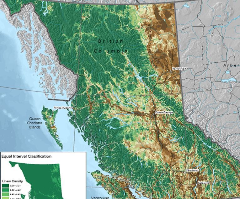
Caslys produced a series of maps, compiled into an all-inclusive atlas, to help quantify the current state of biodiversity in the Province of British Columbia.
The work was conducted for the Conservation Planning Tools Committee (CPTC) as part of the BC Biodiversity Action Plan. A key part of this assessment was the completion of a series of spatial analyses conducted to quantify current conditions. These analyses included biodiversity values such as: species and ecosystem irreplaceability, ecosystem loss, road density, temperature and precipitation change, air pollution, and timber harvesting. The results were illustrated on maps that provide a ‘management picture’ to help inform the Biodiversity Action Plan and effectively present the results to stakeholders and the general public.
The spatial products generated during this project present an overview of key ecological components of BC and provide context for future biodiversity conservation initiatives. Atlas products produced for this project are currently featured in Biodiversity BC’s publications and promotional material.