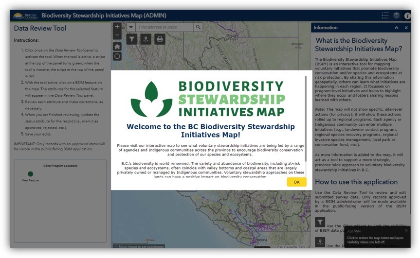
Caslys developed an online Biodiversity Stewardship Tracking Tool for the Province of British Columbia to serve as a centralized location to view and understand stewardship initiatives across the province.
The tool was developed on the ArcGIS Online (AGOL) platform, utilizing Survey123 for data collection. Survey results are displayed to two groups of end users via:
-
A public-access viewer (i.e., web application to be accessed by land owners, farmers, NGO, the Province, etc.), and
-
An internal-only viewer/editor application (i.e., web application with access restricted to members of the AGOL project group).