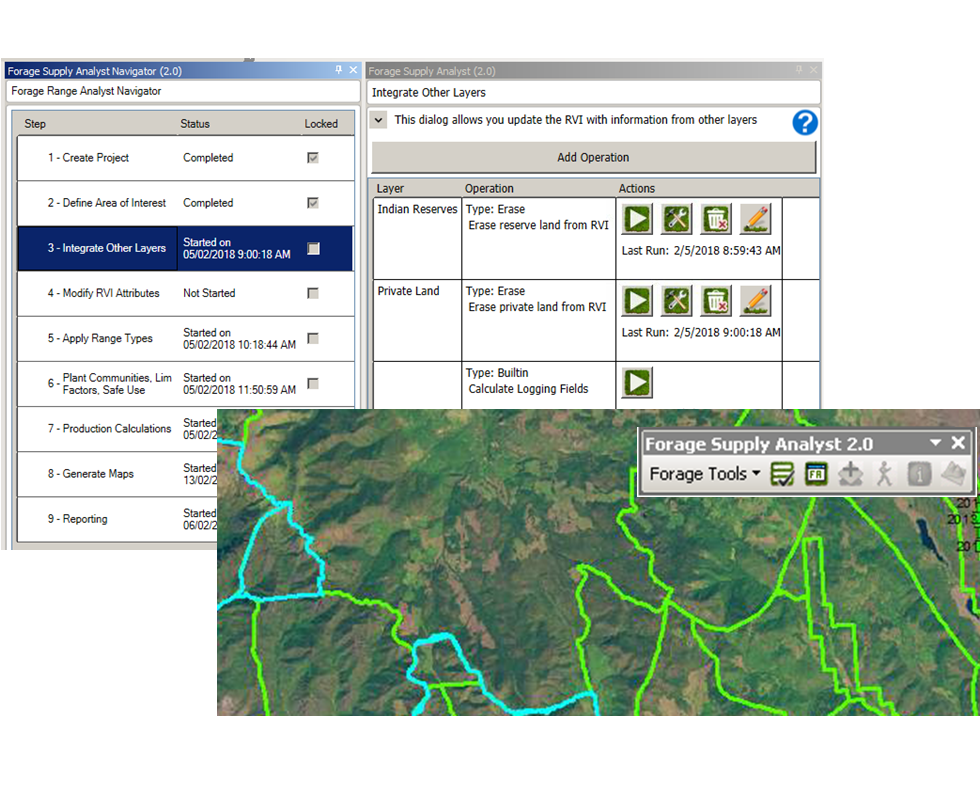
The Forage Supply Analyst (FSA) was developed by Caslys to conduct Range Vegetation Inventories (RVI) that quantify the amount of available forage for a user-defined area of interest in British Columbia. The project was conducted collaboratively with the B.C. Cattleman’s Association, the Ministry of Forests, Lands, Natural Resource Operations & Rural Development, and the Ministry of Agriculture, who identified a need to automate the generation of both the RVI data and related summary reports. This need was met through the development of an application that integrates existing processes with new tools and functions. The FSA application streamlined the process through the application of standardized analysis steps within a GIS-based environment.
Developed as an ArcMap Add-In, the FSA application allows data conversion, the generation of attributed RVI polygons, and a standard RVI analysis workflow that assists users in conducting the RVI analysis in a more consistent and repeatable manner. The tools associated with the FSA application allow revisions and updates based on desktop analysis, field analysis or input from local area experts. Reporting functions export summary statistics and map outputs, assisting users in conducting RVI spatial analyses in a way that addresses the unique characteristics of the area of interest.