Classification of Intertidal UAV Imagery for Marine Spatial Planning
Intertidal surveys conducted in Esperanza Inlet on the West Coast of Vancouver Island in July 2021 were assessed by Caslys in support of DFO’s key commitments to the national Marine Spatial Planning (MSP) and Marine Conservation Targets (MCT) programs. The MCT program is working to protect 25% of national waters by 2025 and to identify potential areas for the establishment of Other Effective Area Based Conservation Measures (OECMs).
Traditional survey tools were used to collect biodiversity and abundance data for intertidal species, specifically the Olympia oyster (SARA species of special concern), as well as newly acquired Unmanned Aerial Vehicle (UAV) technologies to increase the spatial scope of the surveys and to develop new methodologies for monitoring. The main objective of the survey was to assess two Olympia oyster beds, which have been designated as index sites for monitoring, and their associated communities.
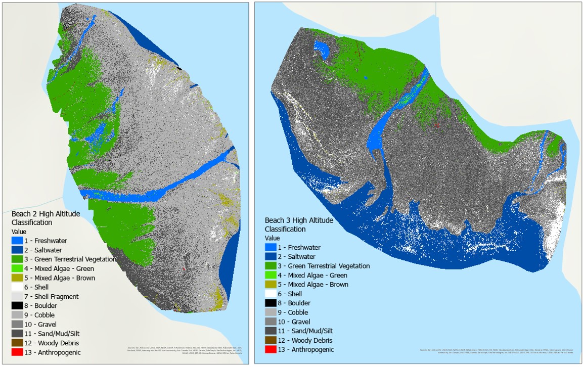
To assess the spatial extent, density, and habitat association of the invertebrate community, Caslys used drone imagery to build species distribution maps and habitat classification layers that relate habitat characteristics (cover type, substrate, and freshwater inputs) at a beach-wide scale to the biodiversity and density of the in-situ data. This work was conducted to support the development of a marine spatial plan for the MSP South Coast area, which includes the Strait of Georgia and Southern Shelf bioregions.