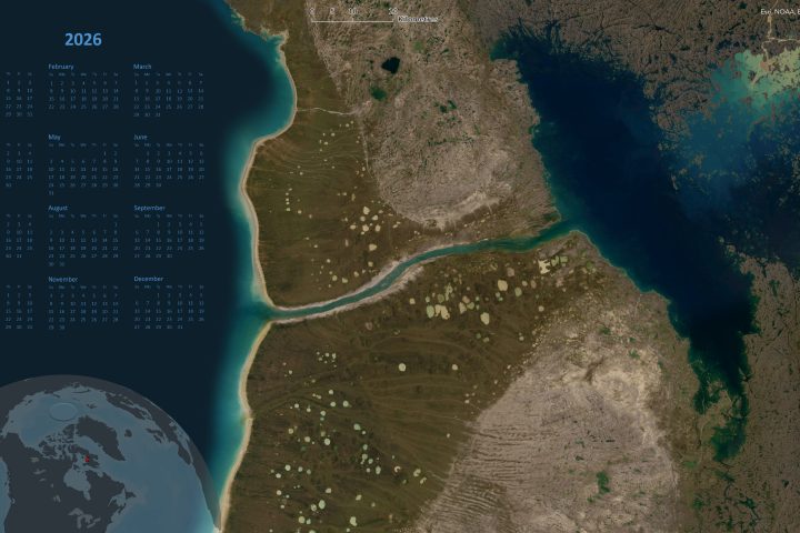
2026 Caslys Consulting Calendars download
Happy New Year from Caslys Consulting Ltd! Below are links to 3 different digital calendar backgrounds created by Caslys Consulting Ltd! Our team at Caslys thought that a fun way to kick off the new year and express gratitude towards all of our customers / cartography enthusiasts would be to share some eye catching satellite imagery calendars. Feel free to download all 3 as well as the monthly versions and let us know which ones are your favourite! Full year calendars: Monthly calendar: About Caslys For over 20 years, Caslys Consulting Ltd. has taken pride in offering a wide range...Continue reading→

Caslys News covers a range of topics, from technical advancement to geospatial interests. Check back often to view our staff picks!
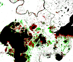
Peace-Athabasca Delta Surface Water Detection
Our remote sensing team at Caslys highlights surface water detection methods in a case study of Northern Alberta and the Peace-Athabasca region. This delta and its dynamic hydrologic environment is a strong example of an area that experiences a high degree of change in surface...Continue reading→
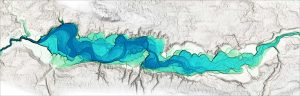
Floodplain Visualization with Relative Earth Models
In this article, we explore how Relative Earth Models (REMs) can be used to visualize floodplains. Fluvial environments have significant natural and anthropogenic roles. Rivers are key features that shape our natural environment and create important ecological habitats. Additionally, they have numerous uses, including those...Continue reading→
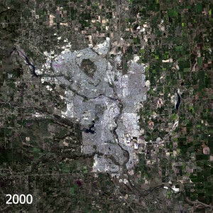
Calgary is Growing – Caslys Monitors Landscape Change
Calgary, Alberta is once again one of the fastest growing cities in Canada. With a constantly evolving city skyline, and growing community boundaries, our team at Caslys thought it would be interesting to apply our landscape change tools to see what’s been happening. We utilized...Continue reading→