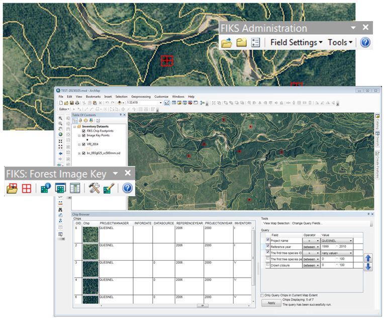
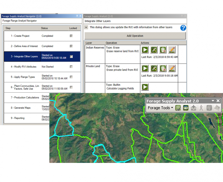
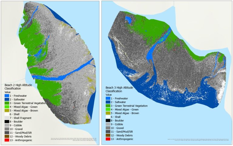
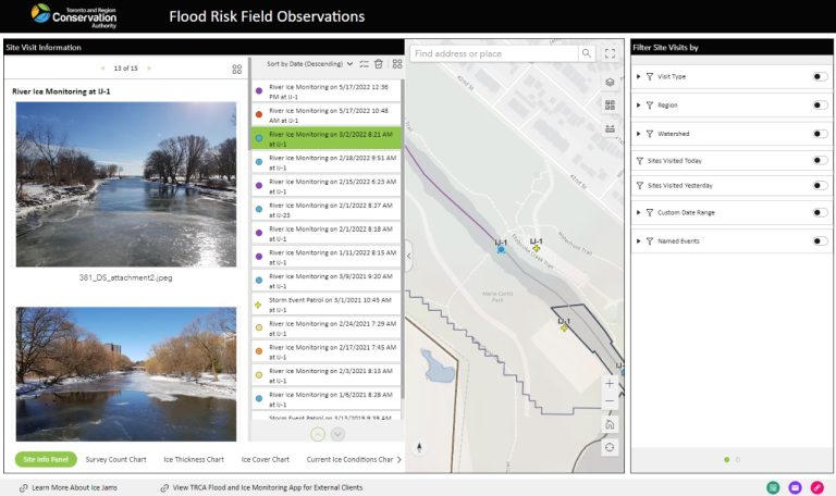
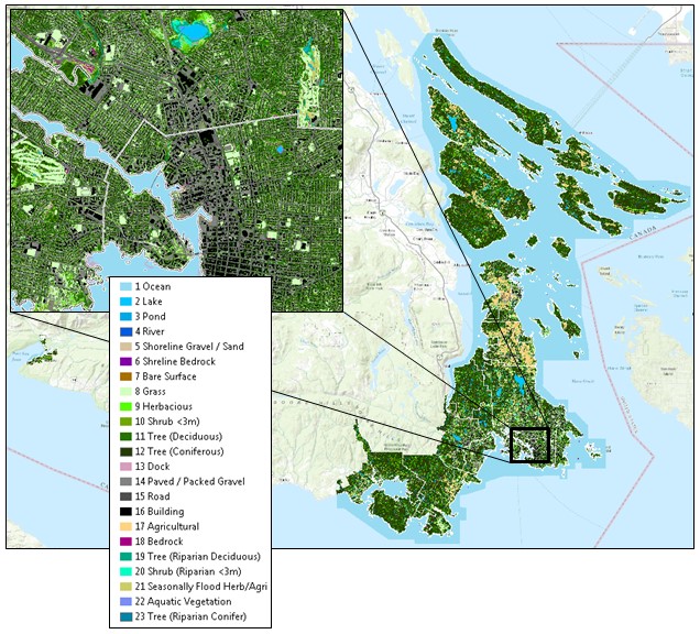
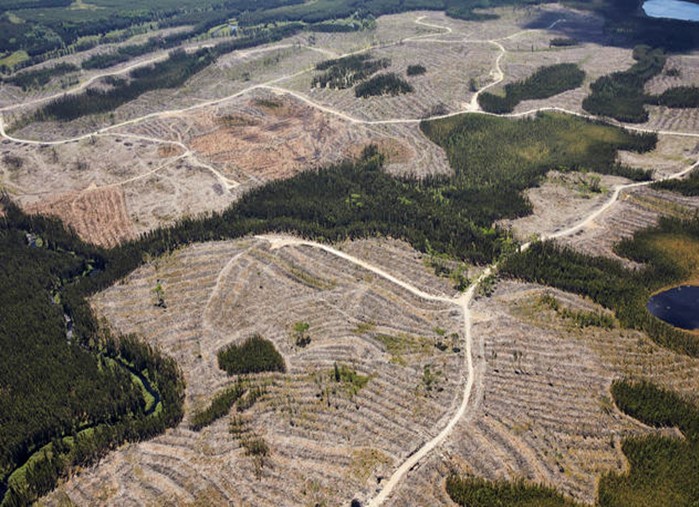
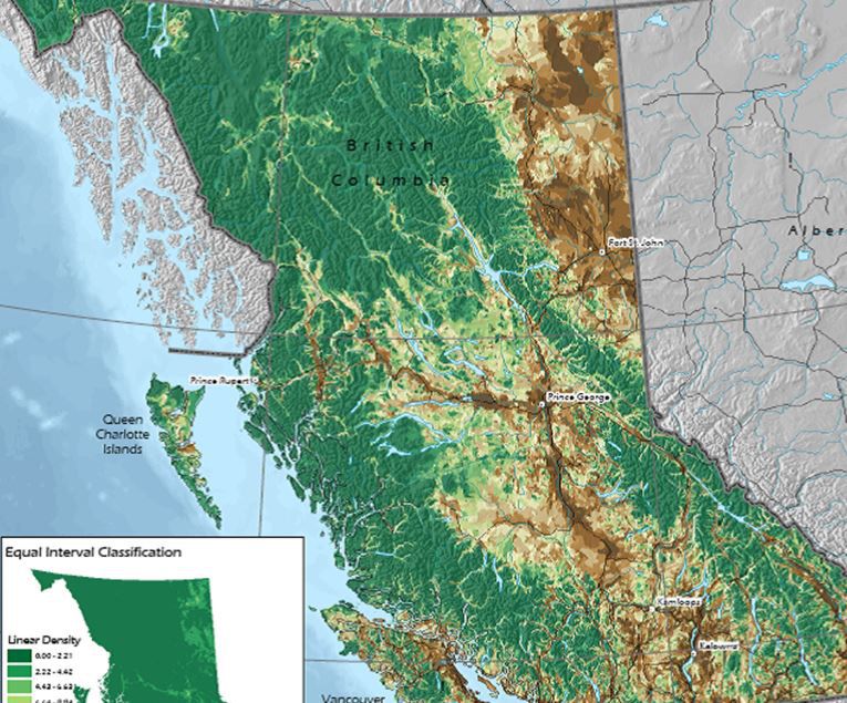
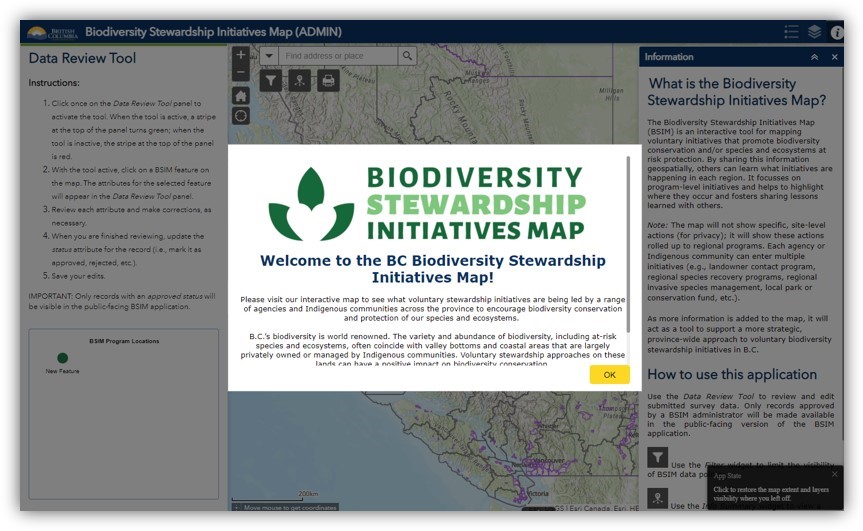
At Caslys, we combine strong technical skills in data management, application development, remote sensing and GIS to deliver successful projects. Our specialists will work with your team to develop solutions to meet your unique business requirements. Forest Inventory Key System Forage Supply Analyst Application Classification of Intertidal UAV Imagery for Marine Spatial Planning Flood Risk Data Collection and Reporting System for the TRCA Land Cover Mapping and Analysis in the Capital Regional District Landsat-8 Harvest Change Detection British Columbia's Biodiversity Atlas Biodiversity Stewardship Initiative Map Application Nunavut Ecological Land Classification (ELC) Agricultural Land Use Inventory for the Province of British Columbia